
Eastern Highlands: Difference between revisions
Units: imperial first, metric in parentheses |
Boundary: highlands reach into northeastern Gostiria, ending just south of the Itanha Forest |
||
| (6 intermediate revisions by the same user not shown) | |||
| Line 1: | Line 1: | ||
{{Subregions of Balúrail Infobox | {{Subregions of Balúrail Infobox | ||
|Name=Eastern Highlands | |Name=Eastern Highlands | ||
|Image=[[File:Mazissage Mountains from the Wilds.jpg|center|frameless|Mazissage Mountains from | |Image=[[File:Mazissage Mountains from the Wilds.jpg|center|frameless|Mazissage Mountains from Eimbuver]] | ||
{{center|Mazissage Mountains from | {{center|Mazissage Mountains from [[Eimbuver]]}} | ||
|Location=[[File:Balúrail Location Méniail Political Map.png|center|frameless]] | |Location=[[File:Balúrail Location Méniail Political Map.png|center|frameless]] | ||
[[File:Eastern Highlands.jpg|center|frameless|Eastern Highlands]] | [[File:Eastern Highlands.jpg|center|frameless|Eastern Highlands]] | ||
|Realm=Balúrail | |Realm=Balúrail | ||
|Largest City=Arremíria | |Largest City=Arremíria | ||
|Size= | |Size=93,967 mi² (243,373 km²) | ||
}} | }} | ||
{{Subregions of Balúrail Sections | {{Subregions of Balúrail Sections | ||
|Introduction=The '''Eastern Highlands''' are a region of [[Balúrail]], located just to the west of the [[Mazissage Mountains]], consisting of the foothills of that range as well as large swaths of boreal forest. The Eastern Highlands are | |Introduction=The '''Eastern Highlands''' are a region of [[Balúrail]], located just to the west of the [[Mazissage Mountains]], consisting of the foothills of that range as well as large swaths of boreal forest. The Eastern Highlands are thinly settled outside the state of [[Gurverde]], which the [[League of Balúrail]] chartered in 786 ME. The territory of [[Eimbuver]], organized in 790 ME, covers the north. The largest city is [[Arremíria]], situated on the shore of [[Lake Arrerem]]. | ||
|Geography=The Eastern Highlands are bounded | |Geography=The Eastern Highlands are bounded in the west by the [[Diate River]] and its tributaries. In the south they reach into northeastern [[Gostiria]] and end just south of the Itanha Forest, where the land falls to the coastal plain of the [[Western Lowlands]]. The [[Sirilquito Hills]] and [[Lake Arrerem]] lie in their southern part. The highlands consist primarily of foothills and large, uninterrupted forests. | ||
Most of the highlands' [[Tuzquão]] live in Gurverde, centered around Arremíria and Lake Arrerem. The southern extent of the region lies in northeastern Gostiria, around the Itanha Forest and Lake Matago. The territory of Eimbuver occupies much of the northern portion of the Highlands and is inhabited only by about 7,000 free [[Mifajene]]. | |||
The largest geographic feature is the [[Doye Forest]], which spans a significant portion of | The largest geographic feature is the [[Doye Forest]], which spans a significant portion of Eimbuver. | ||
=== Cities === | === Cities === | ||
{{see also|List of | {{see also|List of Settlements in Balúrail}} | ||
The largest city within the Eastern Highlands is [[Arremíria]], located on the shore of [[Lake Arrerem]]. | The largest city within the Eastern Highlands is [[Arremíria]], located on the shore of [[Lake Arrerem]]. | ||
{{ | {{Table|class="wikitable sortable" | ||
! Name | ! Name | ||
! Population | ! Population | ||
! Founded | ! Founded | ||
{{!}}- | |||
{{!}} [[Arremíria]] | |||
{{!}} data-sort-value="45000" {{!}} 45,000 | |||
{{!}} 656 ME | |||
{{!}}- | |||
{{!}} [[Figo]] | |||
{{!}} data-sort-value="31000" {{!}} 31,000 | |||
{{!}} 598 ME | |||
{{!}}- | |||
{{!}} [[Terizado]] | |||
{{!}} data-sort-value="22000" {{!}} 22,000 | |||
{{!}} 830 ME | |||
{{!}}- | |||
{{!}} [[Tabau]] | |||
{{!}} data-sort-value="20000" {{!}} 20,000 | |||
{{!}} 702 ME | |||
{{!}}- | |||
{{!}} [[Beltara]] | |||
{{!}} data-sort-value="14000" {{!}} 14,000 | |||
{{!}} 795 ME | |||
{{!}}- | |||
{{!}} Aribo | |||
{{!}} data-sort-value="4400" {{!}} 4,400 | |||
{{!}} | |||
{{!}}- | |||
{{!}} Arpe | |||
{{!}} data-sort-value="3300" {{!}} 3,300 | |||
{{!}} | |||
{{!}}- | |||
{{!}} Casso | |||
{{!}} data-sort-value="4600" {{!}} 4,600 | |||
{{!}} | |||
{{!}}- | |||
{{!}} Craol | |||
{{!}} data-sort-value="4800" {{!}} 4,800 | |||
{{!}} | |||
{{!}}- | |||
{{!}} Foura | |||
{{!}} data-sort-value="3600" {{!}} 3,600 | |||
{{!}} | |||
{{!}}- | |||
{{!}} Garafo | |||
{{!}} data-sort-value="4600" {{!}} 4,600 | |||
{{!}} | |||
{{!}}- | |||
{{!}} Nossa | |||
{{!}} data-sort-value="3300" {{!}} 3,300 | |||
{{!}} | |||
{{!}}- | |||
{{!}} Poeira | |||
{{!}} data-sort-value="4400" {{!}} 4,400 | |||
{{!}} | |||
{{!}}- | |||
{{!}} Polista | |||
{{!}} data-sort-value="4300" {{!}} 4,300 | |||
{{!}} | |||
{{!}}- | |||
{{!}} Pordiz | |||
{{!}} data-sort-value="4400" {{!}} 4,400 | |||
{{!}} | |||
{{!}}- | |||
{{!}} Saye | |||
{{!}} data-sort-value="2700" {{!}} 2,700 | |||
{{!}} | |||
{{!}}- | |||
{{!}} Tuyana | |||
{{!}} data-sort-value="3300" {{!}} 3,300 | |||
{{!}} | |||
}} | |||
=== Climate === | === Climate === | ||
The | The Eastern Highlands are slightly milder than the Western Lowlands, but their elevation largely offsets the difference. Winters are long and cold and summers short and warm, and the foothills grow colder toward the mountains. The highlands are drier than the coast. | ||
=== Flora and Fauna === | === Flora and Fauna === | ||
{{see also|Flora and Fauna of Balúrail}} | {{see also|Flora and Fauna of Balúrail}} | ||
|Gallery={{Slideshow| | |Gallery={{Slideshow| | ||
Balúrail Lake Barite Painting 01.jpg :: A painting of Lake Barite in | Balúrail Lake Barite Painting 01.jpg :: A painting of Lake Barite in Eimbuver. | ||
Balúrail Arremíria Photo 01.jpg :: A photo of Arremíria, ca. 885. | Balúrail Arremíria Photo 01.jpg :: A photo of Arremíria, ca. 885. | ||
Payalawa Fauna Preguio Painting 01.jpg:: A painting of a Preguio, a rare herbivore in the Eastern Highlands. | Payalawa Fauna Preguio Painting 01.jpg:: A painting of a Preguio, a rare herbivore in the Eastern Highlands. | ||
}} | }} | ||
}} | }} | ||
Latest revision as of 02:50, 12 October 2026
| Eastern Highlands | |
|---|---|
| Image |  Mazissage Mountains from Eimbuver |
| Location |   |
| Realm | Balúrail |
| Largest City | Arremíria |
| Size | 93,967 mi² (243,373 km²) |
Introduction
The Eastern Highlands are a region of Balúrail, located just to the west of the Mazissage Mountains, consisting of the foothills of that range as well as large swaths of boreal forest. The Eastern Highlands are thinly settled outside the state of Gurverde, which the League of Balúrail chartered in 786 ME. The territory of Eimbuver, organized in 790 ME, covers the north. The largest city is Arremíria, situated on the shore of Lake Arrerem.
Geography
The Eastern Highlands are bounded in the west by the Diate River and its tributaries. In the south they reach into northeastern Gostiria and end just south of the Itanha Forest, where the land falls to the coastal plain of the Western Lowlands. The Sirilquito Hills and Lake Arrerem lie in their southern part. The highlands consist primarily of foothills and large, uninterrupted forests.
Most of the highlands' Tuzquão live in Gurverde, centered around Arremíria and Lake Arrerem. The southern extent of the region lies in northeastern Gostiria, around the Itanha Forest and Lake Matago. The territory of Eimbuver occupies much of the northern portion of the Highlands and is inhabited only by about 7,000 free Mifajene.
The largest geographic feature is the Doye Forest, which spans a significant portion of Eimbuver.
Cities
The largest city within the Eastern Highlands is Arremíria, located on the shore of Lake Arrerem.
| Name | Population | Founded |
|---|---|---|
| Arremíria | 45,000 | 656 ME |
| Figo | 31,000 | 598 ME |
| Terizado | 22,000 | 830 ME |
| Tabau | 20,000 | 702 ME |
| Beltara | 14,000 | 795 ME |
| Aribo | 4,400 | |
| Arpe | 3,300 | |
| Casso | 4,600 | |
| Craol | 4,800 | |
| Foura | 3,600 | |
| Garafo | 4,600 | |
| Nossa | 3,300 | |
| Poeira | 4,400 | |
| Polista | 4,300 | |
| Pordiz | 4,400 | |
| Saye | 2,700 | |
| Tuyana | 3,300 |
Climate
The Eastern Highlands are slightly milder than the Western Lowlands, but their elevation largely offsets the difference. Winters are long and cold and summers short and warm, and the foothills grow colder toward the mountains. The highlands are drier than the coast.
Flora and Fauna
Gallery
-
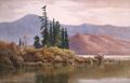 A painting of Lake Barite in Eimbuver.
 -
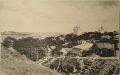 A photo of Arremíria, ca. 885.
 -
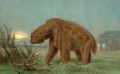 A painting of a Preguio, a rare herbivore in the Eastern Highlands.


