
Eastern Highlands: Difference between revisions
m Text replacement - "Murzak Wilds" to "Mazissage Wilds" |
m Text replacement - "Boiyende" to "Tuzquão" |
||
| (7 intermediate revisions by the same user not shown) | |||
| Line 1: | Line 1: | ||
{{Regions of Balúrail Infobox | {{Regions of Balúrail Infobox | ||
|Name=Eastern Highlands | |Name=Eastern Highlands | ||
|Image=[[File: | |Image=[[File:Mazissage Mountains from the Wilds.jpg|center|frameless|Mazissage Mountains from the Eimbuvère]] | ||
{{center| | {{center|Mazissage Mountains from the [[Eimbuvère]]}} | ||
|Location=[[File:Balúrail Location Méniail Political Map.png|center|frameless]] | |Location=[[File:Balúrail Location Méniail Political Map.png|center|frameless]] | ||
[[File:Eastern Highlands.jpg|center|frameless|Eastern Highlands]] | [[File:Eastern Highlands.jpg|center|frameless|Eastern Highlands]] | ||
| Line 10: | Line 10: | ||
}} | }} | ||
{{Regions of Khamria Sections | {{Regions of Khamria Sections | ||
|Introduction=The '''Eastern Highlands''' are a region of [[Balúrail]], located just to the west of the [[ | |Introduction=The '''Eastern Highlands''' are a region of [[Balúrail]], located just to the west of the [[Mazissage Mountains|Murzakar mountain range]], consisting of the foothills of that range as well as large swaths of boreal forest. The Eastern Highlands are largely uninhabited, although recently the [[League of Balúrail]] has expanded territorial control into the state of the [[Gurverde]], as well as the territory of the [[Eimbuvère]]. The largest city is [[Arremíria]], situated along the coast of [[Lake Arrerem]]. | ||
|Geography=The Eastern Highlands are bounded in the south by the | |Geography=The Eastern Highlands are bounded in the south by the Sirilquito Hills and in the west by the River Cumaro and its tributaries. The highlands consist primarily of foothills and large, uninterrupted forests. | ||
Gurverde is the only area significantly inhabited by the [[Tuzquão]], centered around Arremíria and [[Lake Arrerem]], forming the southern extent of the region. The territory of the Eimbuvère occupies much of the northern portion of the Highlands and is populated only by small bands of [[Mifajene]]. | |||
The largest geographic feature is the Tigore Forest, which spans a significant portion of the | The largest geographic feature is the Tigore Forest, which spans a significant portion of the Eimbuvère. | ||
=== Cities === | === Cities === | ||
| Line 81: | Line 81: | ||
| | | | ||
|- | |- | ||
| | | Terizado | ||
| | | | ||
| | | | ||
| Line 95: | Line 95: | ||
{{see also|Flora and Fauna of Balúrail}} | {{see also|Flora and Fauna of Balúrail}} | ||
|Gallery={{Slideshow| | |Gallery={{Slideshow| | ||
Balúrail Lake Barite Painting 01.jpg :: A painting of Lake Barite in the | Balúrail Lake Barite Painting 01.jpg :: A painting of Lake Barite in the Eimbuvère. | ||
Balúrail Arremíria Photo 01.jpg :: A photo of Arremíria, ca. 985. | Balúrail Arremíria Photo 01.jpg :: A photo of Arremíria, ca. 985. | ||
Payalawa Fauna Preguio Painting 01.jpg:: A painting of a Preguio, a rare herbivore in the Eastern Highlands. | Payalawa Fauna Preguio Painting 01.jpg:: A painting of a Preguio, a rare herbivore in the Eastern Highlands. | ||
}} | }} | ||
}} | }} | ||
Latest revision as of 15:49, 6 August 2026
| Eastern Highlands | |
|---|---|
| Image |  Mazissage Mountains from the Eimbuvère |
| Location |   |
| Realm | Balúrail |
| Largest City | Arremíria |
| Size | 40,254 mi² |
Introduction
The Eastern Highlands are a region of Balúrail, located just to the west of the Murzakar mountain range, consisting of the foothills of that range as well as large swaths of boreal forest. The Eastern Highlands are largely uninhabited, although recently the League of Balúrail has expanded territorial control into the state of the Gurverde, as well as the territory of the Eimbuvère. The largest city is Arremíria, situated along the coast of Lake Arrerem.
Geography
The Eastern Highlands are bounded in the south by the Sirilquito Hills and in the west by the River Cumaro and its tributaries. The highlands consist primarily of foothills and large, uninterrupted forests.
Gurverde is the only area significantly inhabited by the Tuzquão, centered around Arremíria and Lake Arrerem, forming the southern extent of the region. The territory of the Eimbuvère occupies much of the northern portion of the Highlands and is populated only by small bands of Mifajene.
The largest geographic feature is the Tigore Forest, which spans a significant portion of the Eimbuvère.
Cities
The largest city within the Eastern Highlands is Arremíria, located on the shore of Lake Arrerem.
| Name | Population | Founded | |
|---|---|---|---|
| Tuyana | |||
| Sahy | |||
| Faura | |||
| Poeira | |||
| Beltara | |||
| Tabau | |||
| Kraol | |||
| Polista | |||
| Harpe | |||
| Figu | |||
| Aribo | |||
| Nossa | |||
| Arremíria | |||
| Cacho | |||
| Terizado | |||
| Pordiz |
Climate
The climate of the Eastern Highlands is temperate, with frequent cold spells and occasional warm periods. Elevation increases toward the foothills, where temperatures become notably colder.
Flora and Fauna
Gallery
-
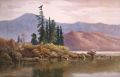 A painting of Lake Barite in the Eimbuvère.
 -
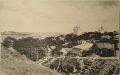 A photo of Arremíria, ca. 985.
 -
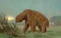 A painting of a Preguio, a rare herbivore in the Eastern Highlands.


